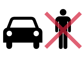
The Wrong Side of my Car
The blog that wants to go obsolete
Why do we hate cycle lanes and bus stops so much?
So, after this miserable saga around Skypath, and equally miserable saga in Grey Lynn, one could wonder why there’s such a backlash against any projects which involve non-cars. People had to coin a new term for it, bikelash. Not that it’s unique to cycling, bus improvements often get similar flak.
(By the way, it’s not a given that the people opposing those projects are a majority. But they definitely are the loudest.)
Why is that? You’d think after decades of trying and piling up debt building roads, it’s time to try something else. There are many rational arguments in favour of de-emphasizing cars and improving other ways to get around — walking, cycling, buses, trains, etc. But those arguments appear to fall on deaf ears.
1m DEM
Last time, one of the questions was, which digital elevation model (or DEM) should I use. Initially I worked with the relatively low-resolution DEM derived from the 20m contour lines.
Of course, Auckland Council has had a 1m DEM derived from lidar data for a while. There’s also a digital surface model, which doesn’t follow the ground level, but which models the ‘surface’ visible from above. You’ll see the buildings and tree tops on that one.
I made a map: relief in Auckland
And now, back to that other interest of me: maps.
One of my favourites is maps showing the relief in the landscape. There’s the relief shading in Google’s terrain maps, or the height contour lines on topographic maps. But I find both hard to interpret. While both are good at showing the local relief, it’s difficult to make out the bigger picture. What I wanted was a map which uses a simple color map to represent elevation.
Let’s make one.

Wsomc’s guide to the Midtown bus route consultation.
Auckland transport is doing another small consultation, this time to figure out how buses coming from New North Road (the successors of the current 221, 223 and others) will return to the west.

The 3 options for the return route are shown in dashed lines. The orange lines show a new proposed route for NEX buses.
Up or out?
One of the classic dilemmas in city planning:

Can we upgrade “living in the CBD” to a proper living arrangement?
Well, I’ve left the building. I’m now living in the ’burbs. Like normal people.

Pedestrian give way rules: “We’re thinking about it”
And now for some good news: the NZTA is investigating road user rules for people walking and cycling. In other words, this Unique Piece of Kiwiana Heritage is going obsolete.
